


Take in the beautiful views of SLO CAL (San Luis Obispo County) and get your steps in along the way! Nearly every SLO CAL destination is home to its own unique terrain and array of hiking trails. From the ocean vistas of Avila Beach to the mountainous overlooks in Santa Margarita, we've compiled this list of some of the most tantalizing trails to get you started. Varying in difficulty, distance and elevation gain, find the SLO CAL hiking trail that is your perfect fit below. Where will the trail take you?
Easy Hikes
Back to Top of List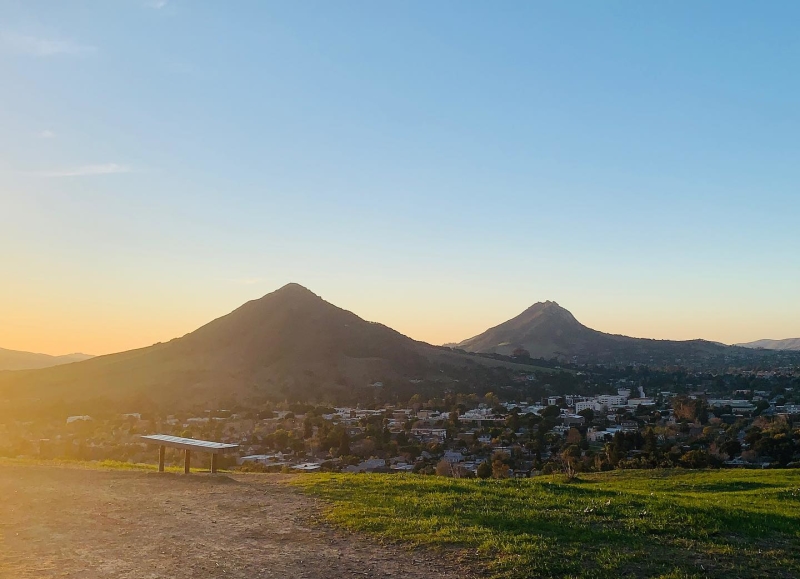
Easy Hikes in SLO CAL
Montaña de Oro Bluff Trail:
Distance: 4.6 miles
Elevation Gain: 370 feet
Trail Type: Loop
Location: Los Osos, CA
Description: This Montaña de Oro trail is perfect for hikers of all skill levels, including beginners. Wildflowers and ocean views make the hike one to bring your camera on, especially in the Spring. Perfect for walking, running or even just a family outing, you'll be able to breathe in the fresh ocean air of the north-facing Pacific Ocean beach with temperate weather all year round. Check the temperature for your most favorable conditions, as this trail is prone to overcast days. Unfortunately, no dogs are allowed on the trail, so the furry family members will have to sit this one out. There are tons of other trails throughout this State Park to explore, and you might even catch a horse crossing, or two.
The Rinconada Trailhead:
Distance: 1 mile
Elevation Gain: 300 feet
Trail Type: Out & back
Location: Santa Margarita, CA
Description: Located off Pozo Road, the Rinconada Trailhead features many adventures in the Los Padres National Forest. But the easiest, and most visually unique is taken to the right of the parking area where an abandoned mine sits with iron stacks and processing machinery all decorated in vivid paint since it became vacant. There are no signs pointing to this hidden wonder, but if you're able to find it among the pathway, less than a mile from the trailhead, you won't be disappointed.
Fiscalini Ranch Preserve:
Distance: 1.8 miles
Elevation Gain: 100 feet
Trail Type: Out & back
Location: Cambria, CA
Description: This historic sanctuary is a wide open haven of trails, mostly visible with the naked eye. If you spot a trail, you'll fairly easily be able to see where to find its entrance. The bluff trail is an ADA compliant boardwalk with benches to overlook a 200-foot cliff and the expansive ocean. If you care to accelerate your excursion to see some more terrain, consider wandering through the Forest Loop to walk in the shade of Monterey pines and sturdy oaks.
Terrace Hill:
Distance: 1 mile
Elevation Gain: 275 feet
Trail Type: Loop
Location: San Luis Obispo, CA
Description: In the middle of San Luis Obispo, this relatively small hill offers 360° views of the community. It is a small hike to reach the summit, but the flat top makes it a perfect spot to catch your breath for a picnic, photoshoot or to simply take in the scenery. When you're atop, you can see the series of mountains stretching to Morro Bay, known as the Seven Sisters. It's second best to hiking one of the Seven Sisters, and best of all, since you're not on top of a mountain, you get to have a picture of all the mountains together. It's a great hike if you want to impress your friends by exerting the least energy possible for the views.
Guiton Trail Oceano Lagoon:
Distance: 1.3 miles
Elevation Gain: 13 feet
Trail Type: Loop
Location: Pismo State Beach, Oceano, CA
Description: The easiest of the easy, this escape is a small loop around the Oceano Lagoon at Pismo State Beach. Perfect for a walk with the kids or even some serene alone time, you'll be done before you know it. If you're looking for more time away, take another pass around. Coastal breezes make this hike manageable, but visually serene place to wander and enjoy the sounds of nature.
Medium Hikes
Back to Top of List
Medium Difficulty Hikes in SLO CAL
Serenity Swing:
Distance: 3.5 miles
Elevation Gain: 725 feet
Trail Type: Out & Back
Location: Peterson Ranch, San Luis Obispo, CA
Description: This trail is one of three trails at Peterson Ranch and is accessible year-round. Located in San Luis Obispo, it is known for the wildlife, the views, and the shady tree at the summit with swings. So, sit back and swing, but be sure to grab a photo of the view before heading back down. And if you choose the path through the Architecture Graveyard, you will be treated to a deteriorating and abandoned village of Cal Poly architectural projects from graduates past. Warning: the incline near the summit of the swing is quite steep. Circle around the Tough and Dirty trail, then follow the fence line back up to the left for a longer, but less strenuous route to the top.
Sycamore Crest Trail:
Distance: 1.5 miles
Elevation Gain: 575 feet
Trail Type: Out & Back
Location: Avila Beach, CA (off of Avila Beach Dr.)
Description: This short trail located in Avila Beach offers scenic views of the ocean and is a great place to watch the sun set any day of the year. It is a steep shortcut to the Ontario Ridge Trail, but much less challenging. The views at the top make it worth the journey. Sit back at the summit, or take things even further if you turn right at the top to hike up even further peek over to Montaña de Oro in the distance. Breathe in the fresh ocean air and catch your breath and don’t forget your furry friend – all leashed dogs are welcome.
Froom Canyon – Irish Hills Preserve:
Distance: 4.1 miles
Elevation Gain: 751 feet
Trail Type: Loop
Location: Irish Hills Open Space, San Luis Obispo, CA
Description: One of eight trails located in the Irish Hills Open Space of San Luis Obispo, this one is on the more difficult side. Dogs are allowed on this trail, but keep them close on a leash. Parts of the trail were previously mining roads, therefore a bit rocky and more difficult to navigate. It has several options to make it longer or more challenging, but don’t miss out on a waterfall feature and beautiful scenic views.
Lone Oak & Peekaboo Loop Tail – Pismo Preserve:
Distance: 5.5 miles
Elevation Gain: 954 feet
Trail Type: Loop
Location: Pismo Preserve, Pismo Beach, CA
Description: The Pismo Preserve offers both stunning coastal views and oak dotted trails for a truly scenic experience. This trail has a gradual incline with gorgeous views of the Pacific Ocean. The Pismo Preserve is open from dawn to dusk, so early mornings & evening sunset hikes are both doable.
Three Bridges Oak Preserve Trail:
Distance: 3.5 miles
Elevation Gain: 670 feet
Trail Type: Loop
Location: Atascadero, CA
Description: This trail offers a loop for easier excursions, or an out and back option for those wanting to extend their time in nature. Take your pooch, but remember to keep them on a leash. This preserve is near Stadium Park, another area where you can hike to see where the infamous Atascadero Monolith spontaneously appeared in 2020. You may be able to catch a glimpse of this, and many other unique sites around this quaint SLO CAL town.
Hard Hikes
Back to Top of List
Hard Hikes in SLO CAL
Reservoir Canyon Trail:
Distance: 5.35 miles
Elevation Gain: 1,350 feet
Trail Type: Out & Back
Location: Reservoir Canyon National Reserve, San Luis Obispo, CA
Description: From the summit, the peaks and valleys of the Central Coast can be seen in a 360° panorama. However, this trail is not for the ordinary hiker. In order to reach the summit, hikers must climb 1,350 feet, with 800 feed in the last mile. Many side trails can lead the adventurous to a waterfall or an old bell tower. Either way, all the triumphant are rewarded with surreal panoramic views. If you want to make this hike into a head-down exercise, consider summiting from Lizzie Street, off of Johnson Avenue in San Luis Obispo. This non-stop incline will hasten even the most experienced climbers heart. Don't forget a water bottle, if you summit from either side.
Cerro San Luis:
Distance: 4 miles
Elevation Gain: 1,350 feet
Trail Type: Out & Back
Location: San Luis Obispo, CA
Description: One of the most iconic landmarks of San Luis Obispo is Cerro San Luis, also known as Madonna Mountain. With its iconic M, the lettering represents Mission High School, an institution located near the bottom of the mountain. Hikers can utilize all the trails from the Fernandez Road parking area. Be sure to lock your doors and grab your water bottle. Follow the Lemon Grove Loop to the Rock Garden Trail to summit the peak. Often climbed as a out-and-back trail, more adventurous hikers can utilize the full summit loop back down by the M. If you're interested in just exploring the M, there's a trail for that, too. Watch out for the bell of mountain bikers who sometimes fly down the summit, but the trail is wide enough to share cross-traffic and maintain a safe distance.
Grey Pine Trail:
Distance: 4.4 miles
Elevation Gain: 1,292 feet
Trail Type: Out & Back
Location: Santa Margarita Lake Reserve, Santa Margarita, CA
Description: This trail leads hikers through the forest to Santa Margarita Lake. Along the way, there is beautiful greenery, a meadow and lake views. It costs $12 to park and there is a $4 fee for dogs. The fee is for the whole day, and there are many trails to explore and around the lake.
That's not all! Learn more about SLO CAL hiking trails here.
